Français
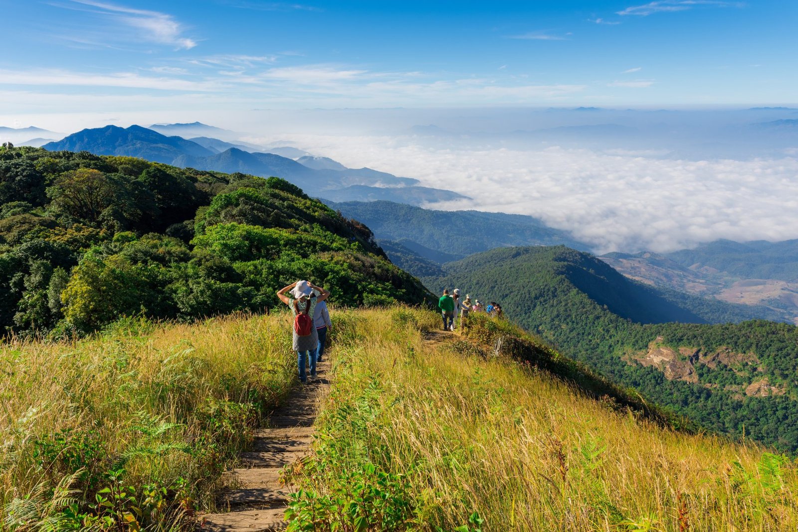
Articles
The Best Hikes and Treks in the Chiang Mai Area
Where and how to go hiking around Chiang Mai
With a population and surface area comparable to that of France, Thailand is endowed with a diversity of flora and fauna that easily explains its attraction for tourists. While the South is famous for its islands and crystal-clear waters, the North conceals treasures of a different kind. In this region, wedged between Laos and Myanmar and close to the Golden Triangle, the foothills of the Himalayas start to rise, creating a landscape of green mountains and tropical jungle stretching as far as the eye can see. For a long time the highest and most extensive mountains in Thailand attracted no tourist activities, either because of ignorance or because of lack of interest. ‘Trekking stays’ were sold to tourists in Chiang Mai, Chiang Rai and Mae Hong Son, but they were merely short strolls designed to arrive at some hill-tribe village to spend the night. Trail running and hiking were almost non-existent in 2013 when Thailand Mountain Trail began to explore the mountainous areas around Chiang Mai. In the course of a few years, thanks to the creation of long trekking routes and hiking paths, both tourists and Thais have greatly expanded the practice of these two activities. Chiang Mai has become the outdoor activity capital of South East Asia and is gearing up to receive the Trail-running World Championships this year for the first time.
Heading north: a truly mountainous region
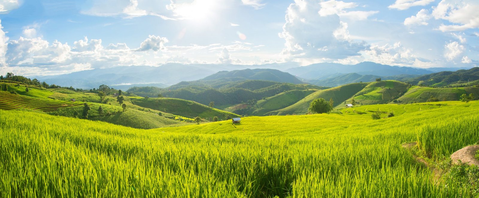
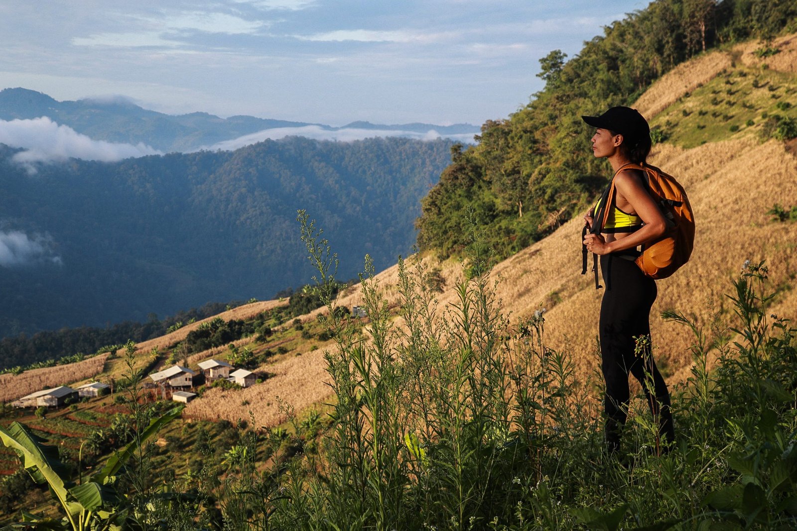
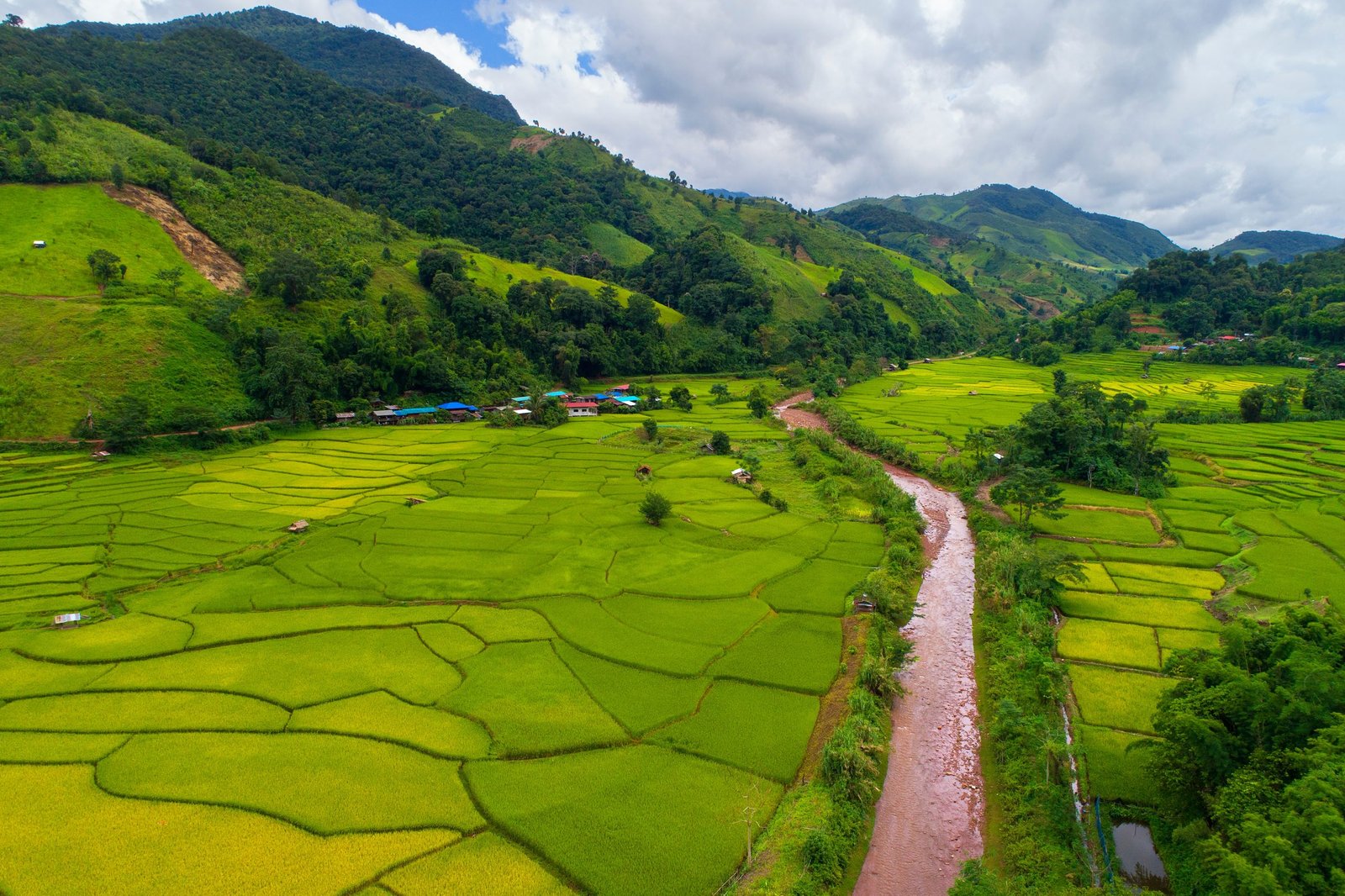
More than 600 kilometres north of Bangkok, leaving behind the central plains where Sukothai, Ayutthaya and Kanchanaburi (with its famous River Kwai) are variously located, the terrain abruptly rises up into a wild rugged landscape. Over an area almost 300 kilometres wide by 300 kilometres long a thick carpet of wet tropical rainforests, temperate rainforests and pine forests covers the entire region. From altitudes of 500 metres to 2500 metres hills and precipitous peaks follow on in unbroken succession, creating in the northern provinces the highest and most extensive mountain ranges in all Thailand. Dotted here and there on the hillsides and high plateaux stand villages built of bamboo or teak. Ethnic minorities, including Hmong, Lisu, Karen, Lahu and Akha, migrated from Myanmar or Laos and settled there in the course of the last century. In the fertile valleys, during the monsoon season, rivers and waterfalls brimming with water irrigate terraced rice paddies and coffee plantations.
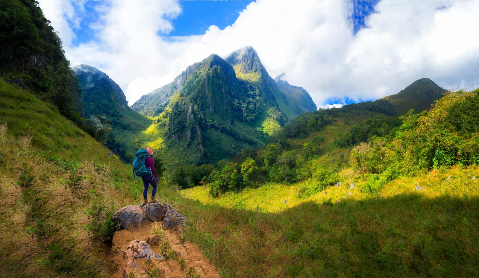
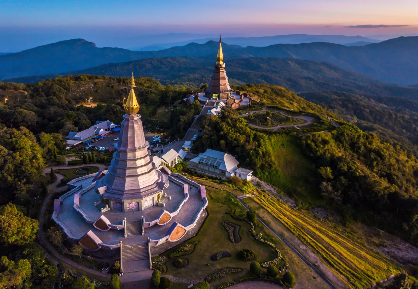
In the middle of this natural paradise stands the city of Chiang Mai, capital of the North and second largest city in the kingdom. Snuggling in a wide valley, the city is rich in history and traditions inspired by its prolific past. It was the old capital of the Kingdom of Lanna, and its historic centre is moated and walled. Forming a true bridge between past and present, Chiang Mai is proud of its 3000 temples, a national record! For those who love mountains and sport, it is ideally located amid the most beautiful national parks and the highest mountains in the North. All around this charming city are jungle-covered hills, slender peaks and limestone outcrops, rice paddies and hill-tribe villages. The province of Chiang Mai is home to four of the five highest mountains in Thailand and abounds in peaks over 2000 metres high. Less than two hours away by car are opportunities unparalleled elsewhere in the country for day hikes, short hikes from a base or ‘point to point’ extended treks with a new base every night.
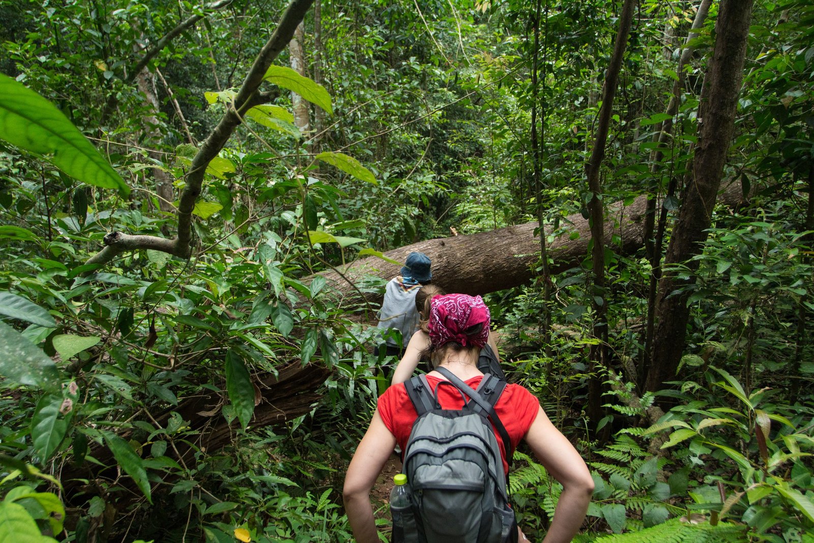
For a long time it was difficult to hike or go running in the mountains around Chiang Mai. There were no marked footpaths or records of long tracks to help a hiker seeking space and exercise. Similarly, no agency or guide was familiar with the various mountainous areas and the paths across them. Consequently, it was impossible to enjoy the benefits of these mountains and to hike up to their highest peaks. That situation changed a dozen years ago when Thailand Mountain Trail decided to research the old paths previously used by the hill tribes.
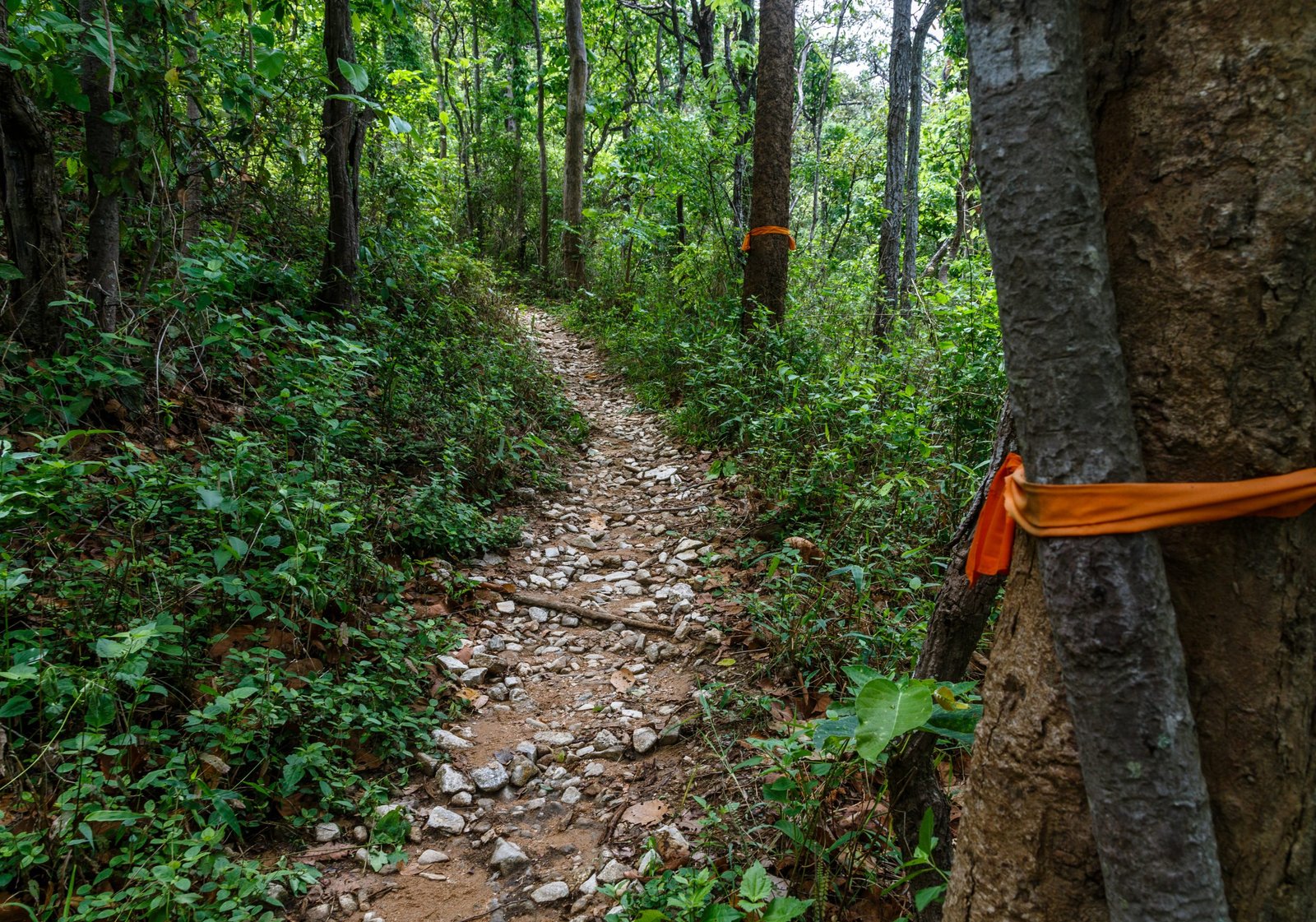
These paths, which had been used to move between villages or inside the forest, had gradually begun to disappear when the first beaten-earth tracks were created. For over 2 years the TMT agency went out and found local people to help explore the old paths and bring them back to life. With their help the agency recorded and cleared hundreds of kilometres of path to create trails exclusively for trekking and long-distance hiking. It became possible to travel a long distance over several days in the highest mountains of Chiang Mai province. Many new areas were opened up to hikers, and this established the capital of northern Thailand as a stronghold of trekking and trail running in South East Asia.
The Doi Pui – Suthep National Park on Chiang Mai’s doorstep
About 5 kilometres west of Chiang Mai the mountains of Doi Pui and Doi Suthep are among the most popular in the region. At a height of 1060 metres they are home to one of the most sacred temples in Thailand, Wat Phra That Doi Suthep. The area, extending over 260 kilometres, became a national park in 1981. It is named after the two limestone peaks, Doi Pui (1685m) and Doi Suthep (1675m), which overlook the Chiang Mai valley. The entire park is covered in jungle, temperate rainforest and pine forest. It is easy to get there from the city centre by bus, car or scooter.
Doi Pui – Suthep is the perfect place for a day hike from Chiang Mai city. Easy to access, the trekking options are huge, and the vegetation is diversified. The area is home to many points of interests: temples, Hmong villages, peaks, waterfalls… In one day, it is possible to experience different atmospheres, such as the wild tropical jungle, the charm of the hill tribe villages or the magnificent views at the local summits.
Where can you hike in the Doi Pui – Suthep Park?
This is the first mountain that Thailand Mountain Trail explored in 2013. TMT.1 begins here – the first long-distance hiking trail in the country, linking Chiang Mai and Chiang Dao. The possibilities for trekking are now myriad and the paths are busier than ten years ago. From down on the valley floor there are many tracks leading up to the park heights: The Last Man Standing, The Monk Trail, The Caffeine Trail, The Sacred Jungle Trail, The Ancient Opium Route. Our preference goes to the latter two, which are the most exotic and interesting. At its beginning the Sacred Jungle Trail shares the line of the Monk Trail as far as the magnificent temple of Wat Palad, which is hidden in the jungle beside the river. From there it goes off to the famous Wat Doi Suthep temple itself. At that point hikers have two choices. You can go straight up, via the queen’s palace, to the summit of Doi Suthep, at an altitude of 1600 metres.
Once at the top your best option is to come down by a jungle path to the Monthatan waterfall.
The second option is to take The Ancient Opium route to the Hmong villages of Khun Chiang Khian and Ban Doi Pui. From these two villages nestling at the foot of the peak of Doi Pui you have to climb up along a steep ridge to reach the highest point, at an altitude of 1685 metres. From there the view over the Chiang Mai valley and the other northern mountains is magnificent. The fittest hikers can continue on to the summit of Doi Pha Klong, which is visible from Doi Pui, and where there is a Buddha footprint. The walk takes a further two hours. Alternatively, you can take the Caffeine Trail directly back down into the city. The path drops 1000 metres over a distance of 7 kilometres.
The mountains and ridges of Doi Saket
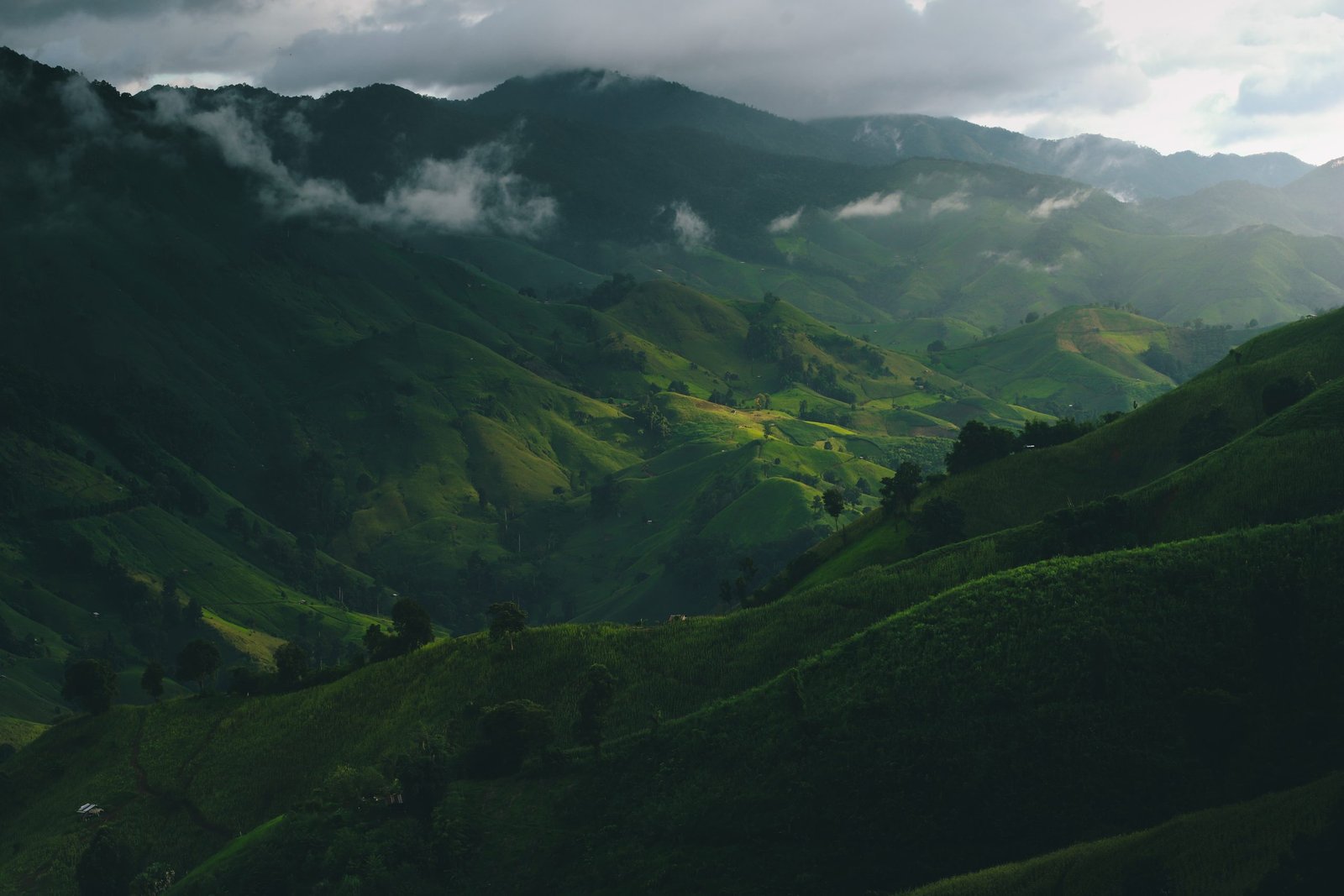
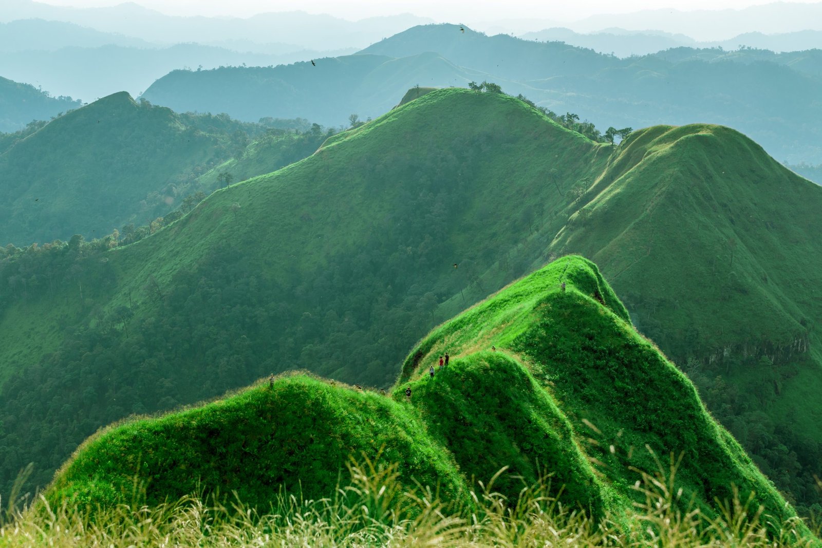
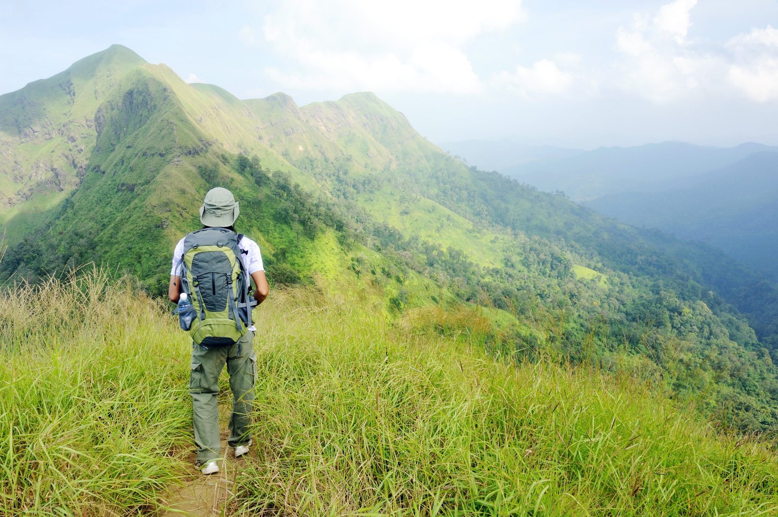
Situated a half hour east of Chiang Mai, these mountains sit astride three provinces (Chiang Mai, Chiang Rai and Lampang). They slope continually upward to a maximum altitude of 2000 metres, but they have their roots in the rice fields of Doi Saket and create folds as they climb, forming a succession of ridges and narrow valleys. The area is wild, and few hill-tribers live there. But a handful of little teak villages such as Mae Kampong and Ban Phok, favoured by their altitude and by the temperate climate, crop up along the river banks near coffee plantations. Higher up, the many exposed rocky ridges offer majestic panoramic views over the surrounding peaks and valleys. In the background Doi Langka Noi (1830m) and Doi Langka Luang (2030m), the final peaks of the massif, stand out. Doi Saket is still unfamiliar territory for hikers, and few trekkers go to the area. Yet it is a magnificent spot with a unique atmosphere and some of the most beautiful views in the whole of the North. The towering forest has stayed untamed, because coffee growing is the one agricultural activity that does not require deforestation. The fact that the area can be reached from the city centre of Chiang Mai in under an hour is a real advantage, and its little teak villages make it an especially suitable area for one-day hikes or for more athletically-demanding two or three-day treks.

Where can you hike in the Doi Pui – Suthep Park?
Let us be honest, it is still difficult to go hiking on Doi Saket on one’s own. There are dozens of old paths that the locals still use, but there is little precise, easily accessible information available about them. Furthermore, the scarcity of mountain villages makes finding accommodation or getting fresh stocks of food difficult without a little pre-organization.
At present the easiest thing to undertake on Doi Saket is a one-day hike. There are two very interesting sectors, both fairly easy to reach and offering magnificent views. Option 1 is to go up to the peaks of Doi Langka, making a loop as you leave the village of Kampaeng Hin. Langka Noi (1830m), the smaller of the two peaks, is easier to reach: allow for 15 kilometres of ground to cover, with a rise of 1300m. Langka Luang (2030m) involves a long and difficult trek requiring at least 7 hours walking. The second area we would recommend for hiking is the country around Mae Kampong. One route leaves the village and goes directly to the peaks of Kio Hin and Kiu Fin (15 kilometres with a rise of 1200m). The second route is shorter – a 4 hour walk – and goes straight to Kiu Fin from the magnificent Mae Kampong waterfalls. For treks lasting several days it will soon be possible, thanks to Thailand Mountain Trail, to hike all the way from Doi Saket right up to the peaks of Doi Langka. TMT 2, Thailand’s second long-distance trekking trail, whose opening is scheduled for 2022, will go over the peaks of Doi Kiu Lom (1490m), Doi Kio Hin (1690m) and Doi Kiu Fin (1800m) before arriving at the two higher peaks. It will pass through the mountain villages of Nam Khong, Kampaeng In, Ban Phok and Mae Kampong, all of which lie at altitudes of over 1000m and will constitute possible staging posts for sleeping and reprovisioning.
Tribal areas in the Mae Taeng district
The district of Mae Taeng lies some fifty kilometres north of Chiang Mai. It is not a park or a reservation nor yet again one of the highest peaks in the country. It is principally a magnificent mountainous region lying to both sides of the river of the same name. Its lower southern area is mainly inhabited by minority Karens, who have built teak villages there, surrounded by terraced rice paddies. The more rugged northern area harbours bamboo Lahu and Hmong villages and contains the highest peaks in the neighbourhood (1700m). The vegetation is very varied: in the valley bottom, on the banks of the Mae Taeng River, stretches of jungle are interspersed with waterfalls; then the mountains rise up and the plant life becomes less dense, pine forest replace rainforest and offers glimpses of peaks and hill-tribe villages through the trees.
If you want to explore the Mae Taeng region you should take treks of at least two days. Getting there by car from Chiang Mai takes at least 1 hour 30 minutes, and one of the attractions of trekking in the area is the chance to spend one or more nights in one of the mountain villages. Do not book one-day hikes or ‘trekking-rafting-elephant’ packages of the sort that tourist agencies often offer. You will merely take a short stroll (2 hours at the most) in flat country or find yourself in elephant camps where the animals receive no respect.
Where should you trek in the Mae Taeng district?
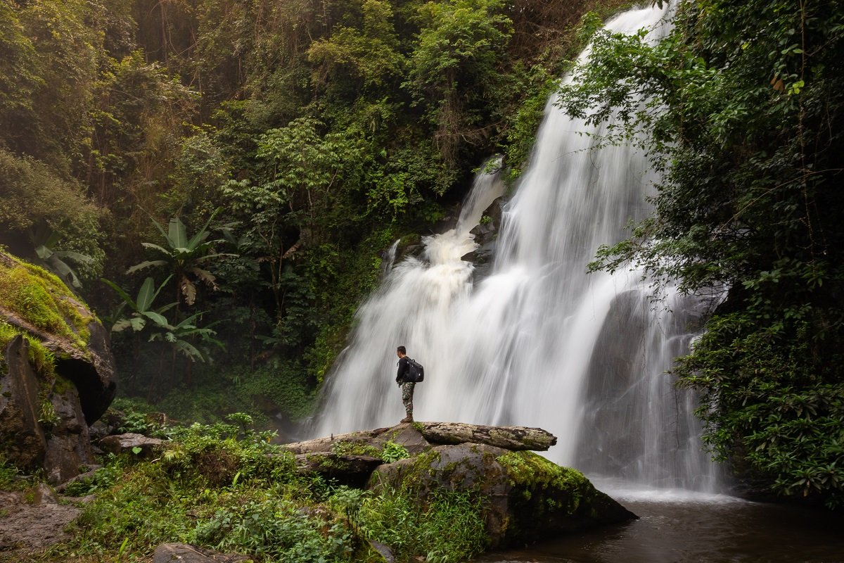
To the north of Mae Taeng, setting out from the magnificent village of Ban Saluang, you can hike towards the mountains and the Karen villages by a jungle path that climbs along the banks of a stream. You should inform yourself about the state of the path beforehand, as it may be necessary to take a machete with you and give yourself extra time, if the locals have not yet cleared the way. Once you reach the Karen village of Mae Kha Piang (where it is possible to spend a night in a bungalow right in the rice fields), you will find other paths that climb higher up to peaks 1500m in altitude. In two days a good hiker can make it as far as the magnificent Wat Prabat Si Roi temple, which is perched like an islet in a sea of mountains. In three days (with an extra night in the Karen village of Pha Taek) you can walk back down through other valleys, finishing at the sublime Mok Fah waterfalls.
In the southern part of the district we recommend you to hike from the village of Sop Kai on the banks of the Mae Taeng River. To start off, you have to take a decidedly wild jungle track along a stream, before climbing up some very steep slopes. Once you reach an altitude of 1000m, the first Lahu villages appear and several peaks stand out in the distance. You should spend the night in one of these villages (Ban Pha Daeng or Huay Satan) before going on to the peaks. It will need a second day to climb up to Doi Pha Samliam (1620m) and Doi Pha Daeng (1600m) before coming back down to Sop Kai, whence you started out. For those who want to add a third day’s hiking, it is possible to go on further north to other villages and peaks (Doi Pha Khia 1580m), finishing at the foot of the Chiang Dao mountain range.
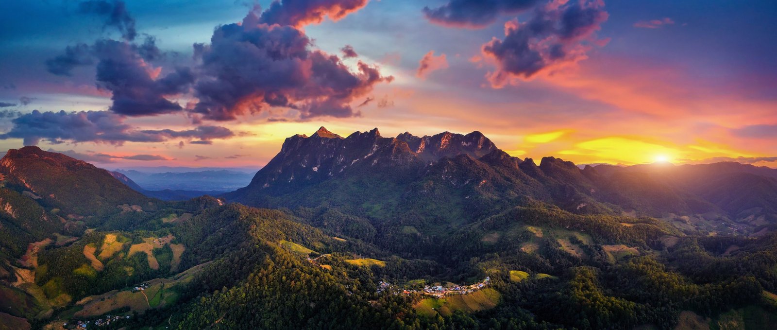
Doi Chiang Dao and its alpine range
The Chiang Dao nature reserve, situated 70 kilometres to the north of Chiang Mai, is unique in its genre. It is the only actual mountain range in Thailand and stretches for several kilometres from east to west. Its limestone cliffs rise up to a number of peaks of 2000m in altitude, of which Doi Luang (2225m) is the third highest in the country. This horseshoe-shaped mountain range harbours an exceptional fauna and flora, which has led to its recognition as a biodiversity reserve by UNESCO. The mountain was classified as a National Park 50 years ago and no longer has any minority villages in its heartland. Access to it is restricted.
Thanks to these measures Doi Chiang Dao has been preserved from all excessive development and from a surfeit of visitors. The price paid is that getting into the heart of the reserve and up to the summit of Doi Luang is now a very complicated process. Over the years the park authorities have closed off all the paths which used to allow hikers to get up to 2225m. There is now only a single route across the massif. The reserve is only open from November to February and you need to book one of the very limited number of access permits well in advance.
Where should you go hiking around Chiang Dao?
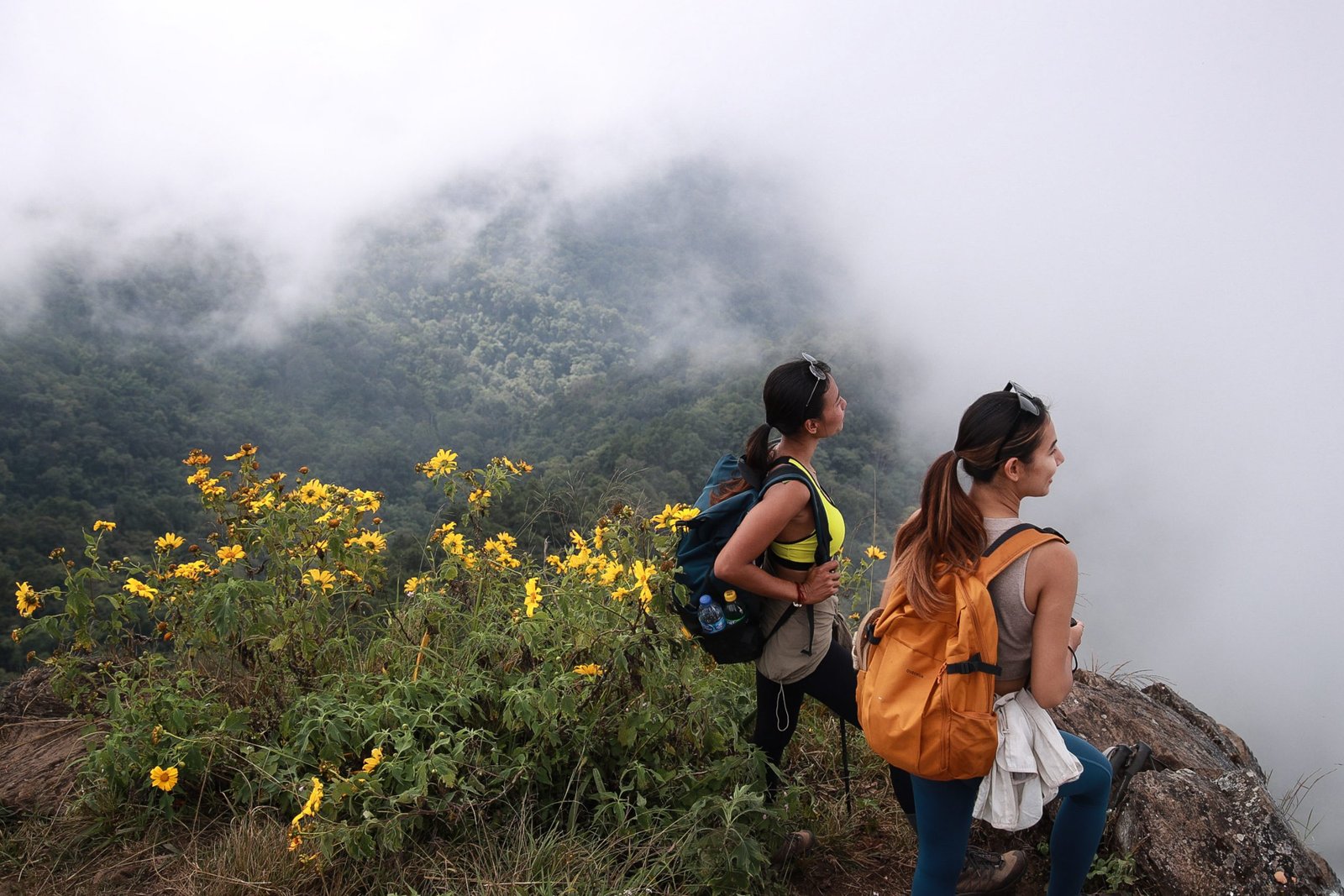
For those few lucky people who get a permit to hike in the reserve, the spectacle is magnificent. The path to the summit (10 kilometres long and rising 1000m) is surrounded by slender peaks and sheer cliffs. The view from the top is awe-inspiring, especially at dawn and sunset; in clear weather you can see all the highest mountains in Thailand. For those not lucky enough to get permission to go into the reserve, there are fortunately other ways to enjoy hiking around Chiang Dao. The mountainous areas outside the reserve are not subject to the same restrictions. They contain many tracks that TMT has restored, with the help of the Hmong and Lisu villagers in the area. So you can hike all around Chiang Dao and enjoy the glorious views over the whole massif.
To the south of Chiang Dao, going up from the valley, there are two routes to the Hmong village of San Pha Khia. The first starts from the hot springs beside the village of Ban Tham and goes up to the foot of the north face of Doi Chiang Dao. The first part of the route, up to 1000m, is quite easy, but the second part is very complicated. The wild path is not kept up at all. Even if you are equipped with a long machete, it is difficult to cut through the giant bamboos. The second route is easier. It leaves the village of Mae Na and follows the mountain ridges for 15 kilometres, rising by 1000m, until it comes to the Hmong village, where you can spend the night. For the second day you are advised to continue your trek on a path which goes round Chiang Dao on the west side as far as the Lisu village of Fa Suay.

The Lady Mountain or Doi Nang, which lies alongside the northern flank of Doi Luang, is also a very fine trekking spot. As it is very wild, you have to make careful preparations before hiking there. The paths are long and receive little or no upkeep; they can be dangerous. As there is no possibility of replenishing stocks at any point in the day, you must organize plenty of water and food before setting out. Four paths out of the valley go to the Lisu village of Nong Khatae. The first goes over the top of Doi Nang at almost 1800m. The second, the easiest, runs below the north face of Doi Nang; the third follows the line of the river Mae Khon. The fourth, the most difficult, follows an exposed ridge, climbing right up to the top of Doi San Kon Phra. The Lisu village is somewhat rudimentary and it is not possible to overnight there. You must either go back down into the valley or return to the village of Fa Suay seven kilometres further south.
Doi Inthanon, the roof of Thailand
At 2565m above sea level Doi Inthanon is the highest mountain in Thailand. Unlike Doi Chiang Dao it is not an alpine massif with high limestone cliffs but a vast hill with plains and rocky summits. The area was made a National Park in 1949 with a view to preserving its exceptional flora. The year-round temperate climate that Doi Inthanon enjoys favours vegetation which can only be found there. The locality is inhabited by Karen and Hmong minorities, who make their living from horticulture thanks to the Royal Agricultural Project, which was initiated there to help them switch from opium growing. Visitors can enjoy the view of kilometres of terraced rice fields at the foot of the green hills.
The National Park lies one and a half to two hours by road to the south of Chiang Mai. So, you should avoid the one-day tours with trekking and other activities sold by tourist agencies in Chiang Mai. The ‘hiking’ will be limited to a 1-2 hour stroll and all the activities will be carried out at the run, with no time to enjoy anything at all. To appreciate what Doi Inthanon has to offer – royal pagodas, Karen villages, terraced rice paddies and numerous gigantic waterfalls – you should spend several days there. There is plentiful accommodation available down in the valley (Jom Tong) or higher up in the hills (Mae Klang Luang, Pha Mon, Ban Khun Klang) but you will need to have your own transport.
Where should you go hiking on Doi Inthanon?
The potential for trekking on Doi Inthanon is considerable, but as yet the Park authorities have not exploited the possibilities. At present there are only short marked paths which the locals have cleaned up and maintained. The nature trails of Kew Mae Pan, Pha Mon, Ang Ka or Pha Dok Sieo give you an opportunity to appreciate the exceptional vegetation or the imposing views of Doi Inthanon, but they only take two hours or so to walk around. Given the large number of visitors, these trails can also become overcrowded.
We do not yet know of any series of hikes from a single base that would allow you to reach certain peaks and get back in one day. Many paths have disappeared and been changed into dirt tracks. Thus, to reach the magnificent peaks of Doi Kaew Mae Pan, Doi Pha Ngen or Doi Pha Tang, the part which can be covered on a real hiking path is reduced to a minimum because there are already roads running right up to the base of these mountains. Only the final climb to the summit can properly be called hiking. Nonetheless, out of all these peaks we do recommend the trek up to Doi Pha Ngen. From the Hmong village of Khun Wang you can do a 3-4 hour loop up to the summit, where the view across the whole National Park is superb.
For long point-to-point treks of several days around Doi Inthanon you must wait for 2023 when Thailand Mountain Trail will have completed TMT.3. The plan is to create a third long distance trekking route, which will start from Chiang Mai, pass through the glorious Mae Wang valley and end at the highest peak in Thailand.
What do you need to know before you embark on a trek in Thailand?
You can hike around the Chiang Mai area at almost any time of year. The best moment to go trekking is during the cold season, which lasts from November to February. Temperatures are mild and can even be quite cool when night falls. The weather is always excellent, with azure skies and completely clear visibility. It is also very pleasant to go hiking in the rainy season from June to October. It usually only rains in the late afternoon or during the night, which does not inconvenience hikers. Indeed, the rain freshens the atmosphere and prevents the heat from becoming too intense. This is the time of year when forest and jungle are at their greenest, dampest and most luxuriant. From July to October is also the period when the rice terraces are looking their loveliest – initially brimming with water, then full of ripening rice before the November harvest. The only period when we would advise against hiking in Chiang Mai is during the hot season from the end of March to the end of May, when slash-and-burn is going on. The weather is far too hot, the vegetation is dried-up and the air is full of smoke.
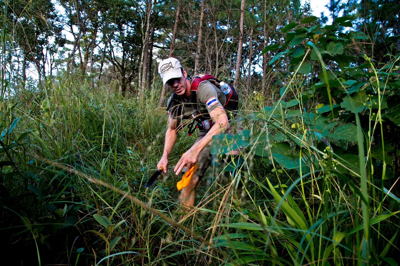
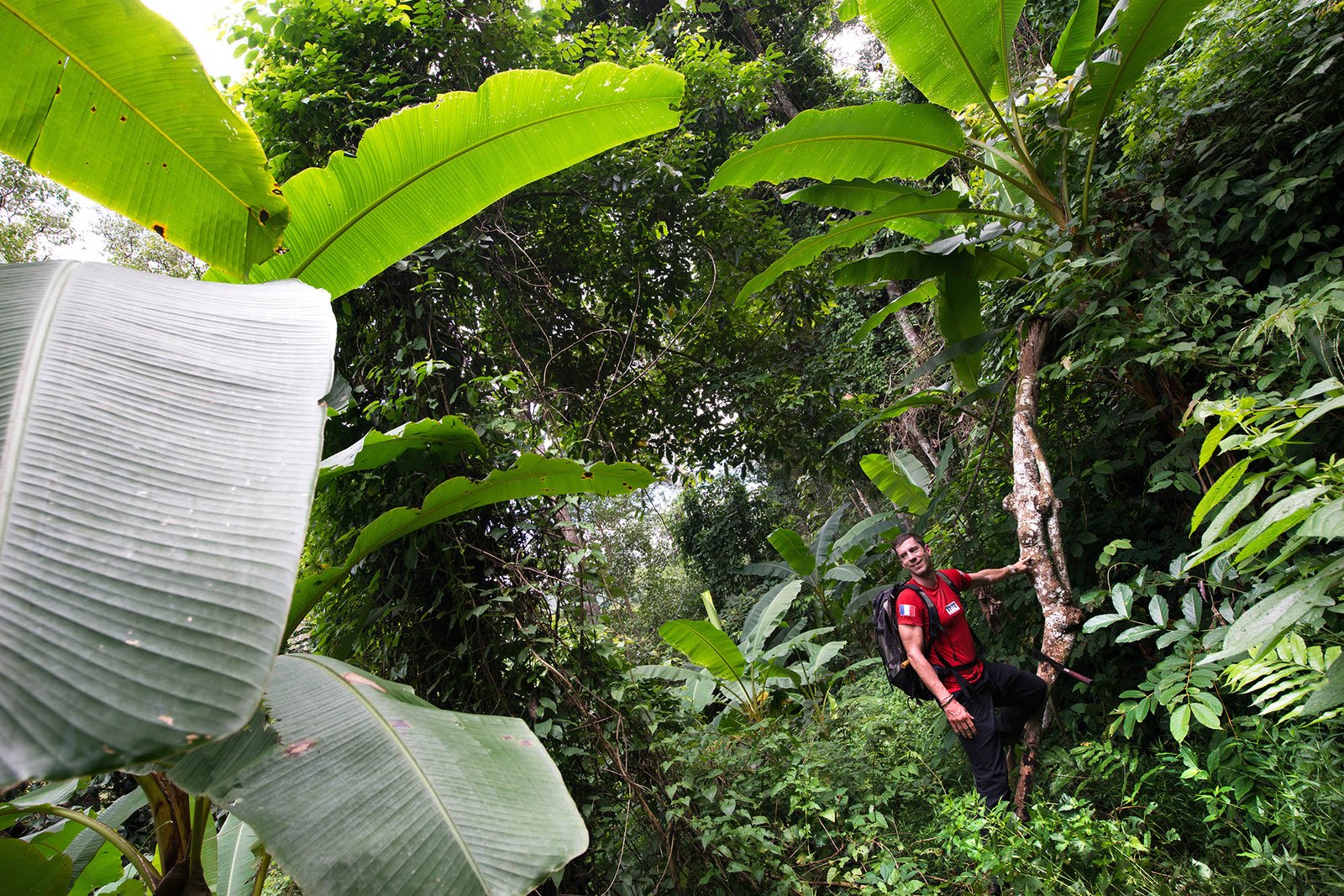
Before hiking around Chiang Mai it is very important to make careful preparations for the trip, taking into account the special characteristics of the area. Trekking here is not at all the same as trekking in Europe or North America. The paths are neither marked nor maintained, so it is very easy to lose your way. If GPS reception is poor deep in the jungle, it is impossible to find your way back to the line of the path. Equally, the paths are not well-kept. During or after the monsoon season it may be impossible to see where the path goes or to advance along it without the help of a machete. Even if you have a machete (watch out for self-inflicted wounds), cutting a way through will require three or four times longer than envisaged, with the risk of still being in the jungle when night falls. Equally, the flora and fauna are very different from those of countries with temperate climates. There are plants on which you can cut yourself badly, and the risk that you may be bitten by snakes (the most dangerous are vipers, cobras and puff adders) or stung by scorpions and centipedes. Last but not least, the hot humid climate makes constant rehydration vital. The risk of running out of water is particularly important if you get lost or if the hike goes on longer than foreseen. If there is a problem, you have only yourself to rely on. There is no organized rescue service of the sort we are used to in the West. Given that the paths are little used, there is not much chance of outside aid, and the phone network is often unavailable, which limits the possibility of calling for help.
It is therefore essential to make thorough preparations beforehand and to avoid any need for improvisation. Without prior organization any small incident can become problematic, even close to Chiang Mai. Here is our basic advice on how to go hiking safely. If you feel unable to respect these points, we strongly advise you to take an experienced friend or relative with you, to hire a guide, or to go with a specialized agency.
- Do not hike or trek on your own
- Consult an experienced hiker when planning your hike
- Do not rely exclusively on information found on the internet
- Make contact arrangements with a Thai speaker whom you can call in an emergency
- Give that person the details of your hike; place, time, transport, expected return time
- Allow for the hike taking twice as long as originally envisioned
- You often have to make a trial run; accept that you have to give up and come back on another occasion
- Take a first-aid kit, a headlamp and a survival blanket with you
- Record the GPS track of your hike and take a Powerbank with you
- Take a machete with you and know how to make judicious use of it
- Work out where you can get food and take twice the quantity of water and energy bars you need.