Français
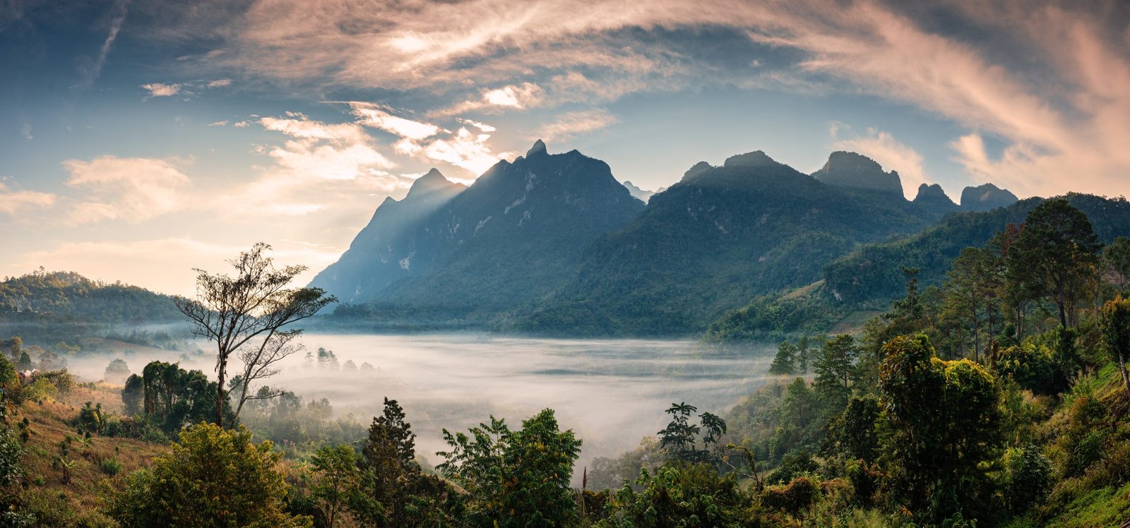
Articles
Thailand’s Highest Mountains
It is no surprise if nature lovers and devotees of breathtaking scenery are drawn to Thailand. The country is famous for its picture postcard landscapes, where turquoise sea meets white sandy beach. Bewitched by the languorous charms of the islands the majority of tourists unfortunately only have eyes for this one seductive facet of the country. But Thailand, a land of contrasts, is also a mountainous country. From north to south it harbours over 150 National Parks in mountainous areas. From the province of Yala on the Malaysian border to the province of Chiang Rai on the Burmese border numerous mountains rise up, forming the foothills of the famed Himalayas. In the south, between the Andaman Sea and the South China Sea, this terrain engenders groups of karst limestone rocks that soar upward out of sea or dry land. In the south you will find them in Krabi, Phang-Nga and Khao Sok. In the north, at the heart of the plains of South East Asia, these folds in the earth’s crust have created green-clad mountains stretching as far as the eye can see. This is the region of Thailand where the changes in elevation are the greatest and where you will find the highest peaks in the country.
Why should you go exploring mountains in Thailand?
Over 600 kilometres north of Bangkok, beyond the extended plains of the old royal cities of Sukothai and Ayutthaya, the northern region stands on the ruins of the former Kingdom of Lanna. The Land of a Thousand Rice-fields (Lan Na) lies between its Burmese neighbor to the west and its Laotian cousin to the east, in the Golden Triangle region. It is a wild region, where mountains and valleys ceaselessly alternate, a trading area where goods and populations are exchanged. Many ethnic minority peoples, originally from southern China and the Himalayan regions, have settled there. The Karen, Hmong, Lisu, Lahu and Akha minorities have covered the slopes and plateaux of the mountains of the North with their teak and bamboo villages, with a consequent gradual reduction in the native fauna. It is now impossible to find the wild elephants and tigers who inhabited the region 50 years ago. The vegetation, however, has retained its very untamed, very diverse character: tropical rainforest (generally known as ‘jungle’) in the hot, wet zones at the foot of the mountains, temperate high-altitude rainforest (similar to European forests) halfway up the mountains, and dry pine forests close to the summits.
This is the region, mainly in the provinces of Mae Hong Son, Chiang Mai, Phayao, Chiang Rai and Nan, where the biggest, highest mountains in the country can be found. The ten Thai peaks over 2000 metres high have all taken up residence there. For nature lovers here are the five ‘must-visit’ mountains in Thailand and the information you will need (specific characteristics, how to access, points of interest, activities, accommodation) if you are to enjoy them to the full.
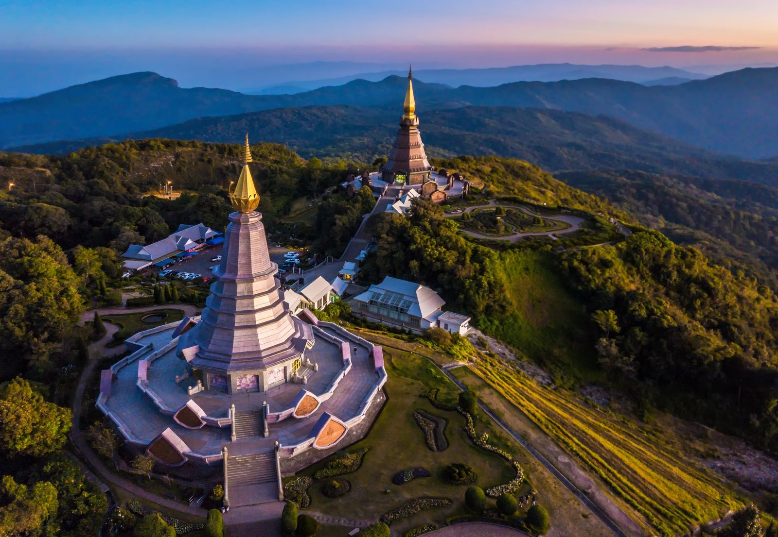
Doi Inthanon, the highest mountain in Thailand (2565m)
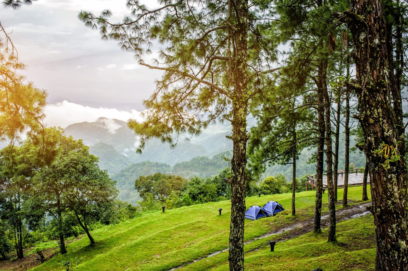
The highest of the Thai mountains, it was named in honour of the last king of Chiang Mai, who had dedicated part of his time to its conservation. The National Park of the same name was established in the mid-20th century and was one of the first such parks in the country. Now it covers an area of almost 500 square kilometres, rising from 800 to 2565 metres in altitude. Thanks to its temperate (rather than tropical) climate, it houses a huge diversity of both flora and fauna. It is where the country’s lowest temperatures are recorded in the cold season – as low as -5˚ on the mountain’s summit. The Doi Inthanon National Park stands in the Jom Tong district of Chiang Mai province. A minibus service goes there from the city, but the frequency of the minibuses is uncertain, which makes it rather difficult to make arrangements. We advise you to go there under your own steam, by car or motor scooter. There is good road access and you will find it easier to move between the different places of interest within the park, some of which are a considerable distance apart.
What is there to do in Doi Inthanon and in its surroundings?
You are advised to spend a minimum of 2 days at Doi Inthanon, to enjoy all the park has to offer. Do not rely on the daily tours touted by the tourist agencies. You will only see the most touristy aspects, you will do it all at top speed, and you will have no time to appreciate all the riches of this unique place. The summit of Doi Inthanon is not particularly interesting, as it is covered in vegetation and does not offer any panoramic views. If you want to enjoy the view of the mountains and valleys in the area to the full, there are neighbouring peaks that we can warmly recommend: Doi Kaew Mae Pan, Doi Pha Ngen, Doi Pha Tung. We also advise you to visit the Royal Pagodas and gardens, from where the view down over the valleys below is superb. Take a little time, too, to visit some ethnic minority villages: the Karen villages of Pha Mon and Mae Klang Luang with their rice terraces; the Hmong village of Ban Khun Klang with its Royal Project agricultural centre. There is also an impressive number of waterfalls, of which the most imposing are Mae Klang, Wachirathan, Mae Ya, Sirithan and Siriphum.
If you want to go hiking on Doi Inthanon, there are no long, marked, cleared, maintained paths. But you can take a few interesting walks on short routes created by the locals: Kew Mae Pan nature trail, Pha Mon nature trail, Ang Ka nature trail, Pha Dok Sieo trail. For real treks you will have to wait for Thailand Mountain Trail to finish setting up TMT.3, a long-distance hiking path linking Chiang Mai to Doi Inthanon.
Doi Pha Hom Phok, a peak above the clouds (2285m)

Thailand’s second peak reaches 2285 metres. Located in the province of Chiang Rai just a few kilometres from Myanmar, this mountain is much less well known than the country’s highest peak. It also has less to offer. The park was created in 2000 and was the 97th National Park in Thailand. It covers 514 square kilometres, rising from 600 to 2285 metres in altitude, above the district of Fang. The name Doi Pha Hom Pok means ‘mountain with a cotton blanket’, a reference to the vapour which emerges from the humid forest canopy and envelopes the peak in the morning. From Chiang Mai and Chiang Rai it takes two or three hours, by car or motor scooter respectively, to reach the park. There is a bus (Chiang Mai to Tha Ton) but you have to walk to the park entrance. We advise you to take your own transport.
What is there to do on Doi Pha Hom Pok and in its environs?
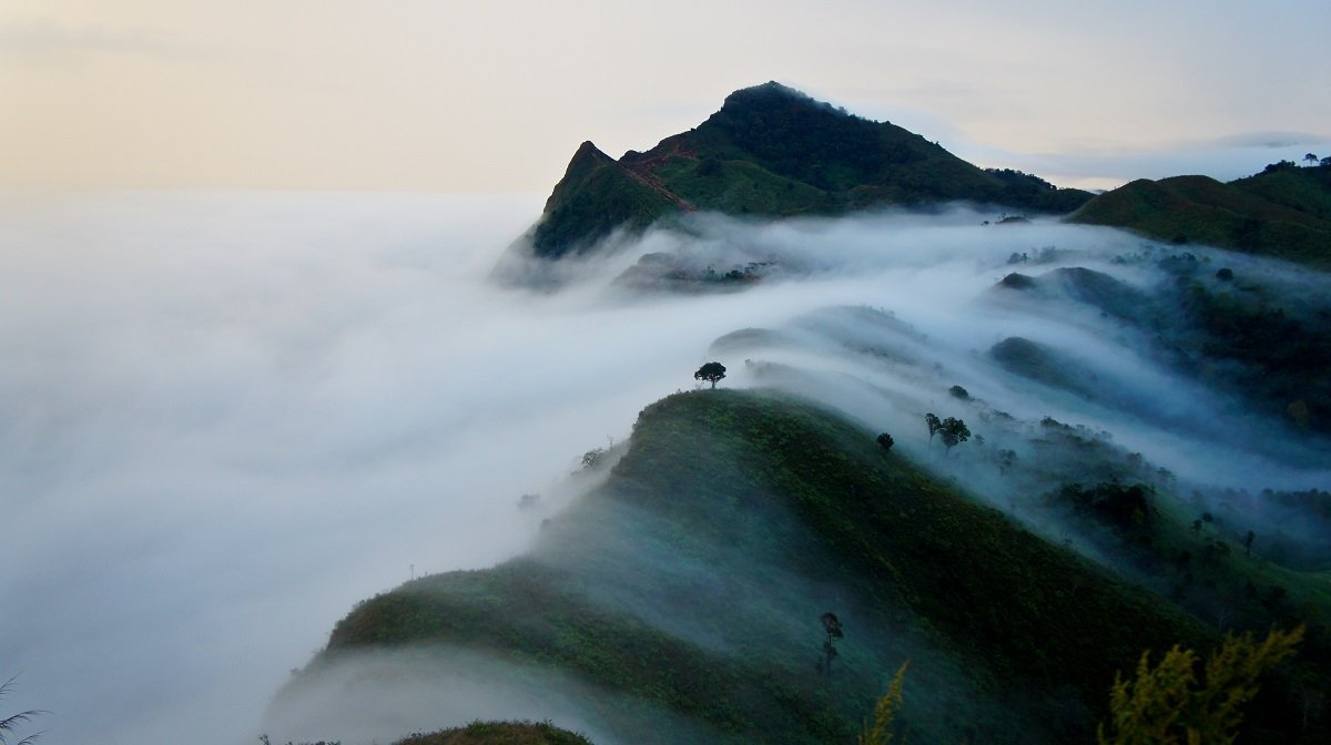
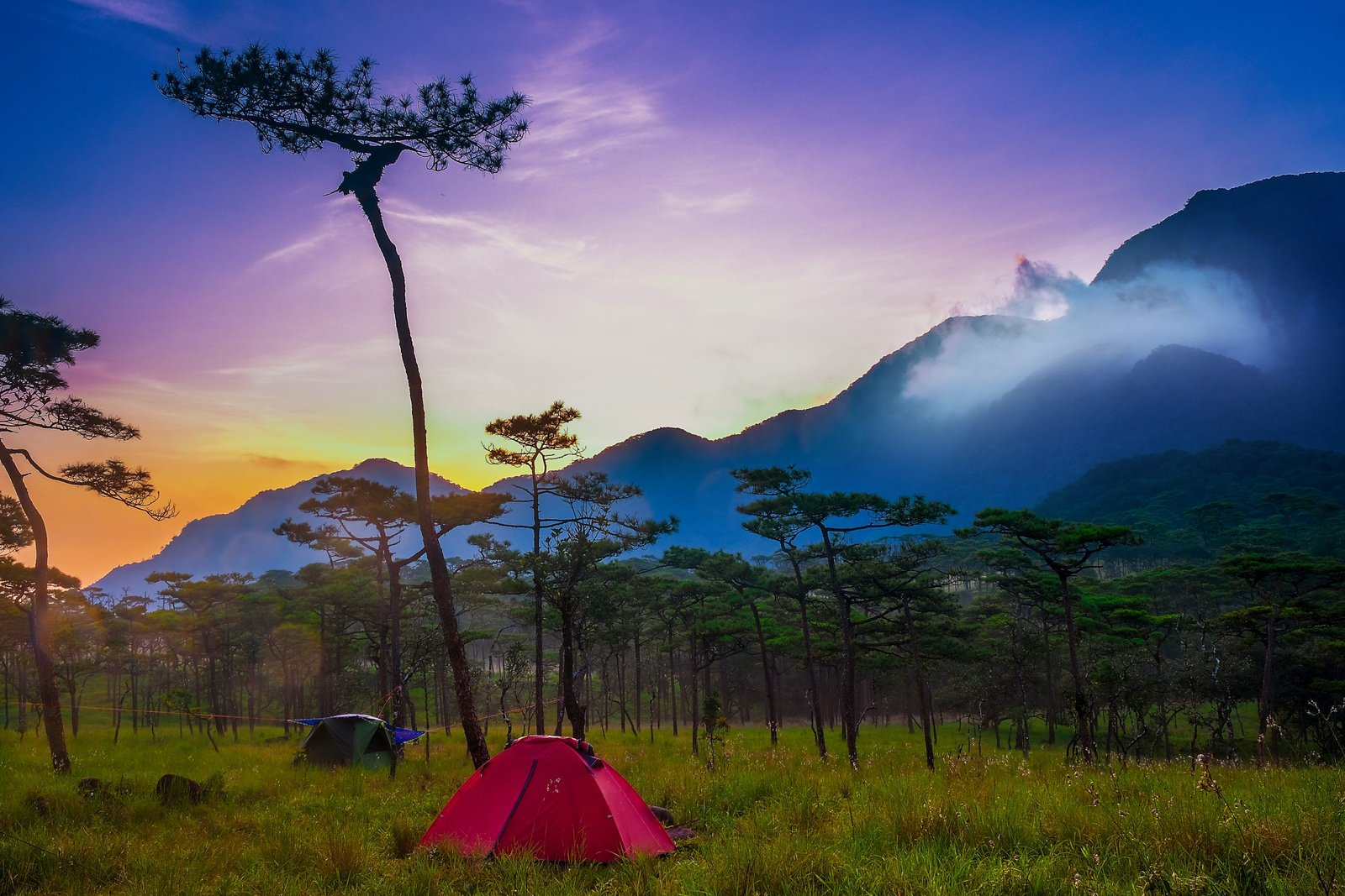
Given how relatively remote Doi Pha Hom Phok is, it is preferable to spend at least two days and one night there. Before going up to the summit, you can take a trip to the fine hot springs at Fang. There are also waterfalls (Tard Luang, Na Ma Urn, Bhoo Muan) and some caves…which are nothing special. We suggest that you go up to the park campsite (which lies at 2000 metres above sea level) by mountain bike or motor scooter. From the park entrance you have to go at least 25 kilometres, rising 1500 metres, on a rough dirt road. Those who are brave enough can make a detour via the small Lahu village of Ban Phu Men, which affords a superb panoramic view over the whole of the valley to the south. From that high up, the view over Myanmar is stunning. If you want to enjoy a sea of cloud below your feet, you should go up there in the morning before sunrise.
Going for longer hikes on Doi Pha Hom Pok is difficult. There is no official track apart from the one that climbs to the summit from the campsite. Thailand Mountain Trail inspected the area several years ago and created two routes to the summit. One starts at Tha Ton down in the valley and the other runs from Doi Ang Khan in the west, another peak 2000 metres high. Contact us if you want to know more.
Doi Chiang Dao, an alpine mountain in Thailand (2225m)
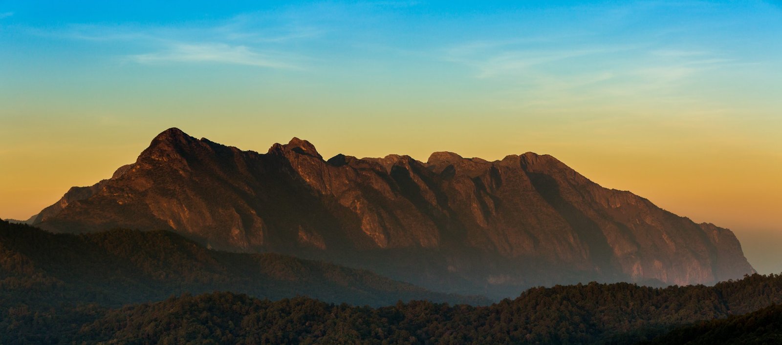
The third highest peak in Thailand is part of the only true mountain range in the country. Unlike Doi Inthanon and Doi Pha Hom Pok, which resemble huge hills (they both have tarmacked roads running almost to the top), Doi Chiang Dao is a genuine limestone range with steep summits, slender peaks and unscalable cliffs. Shaped like a jawbone the mountain stretches from east to west for several kilometres. The main summit is called Doi Luang and reaches 2225 metres, but all around there are other peaks over 2000m high. Originally the Hmong produced opium there, the climate at that altitude being perfect for growing the poppies. Located an hour and a half north of Chiang Mai and covering an area of more than 500 square kilometres, Doi Chiang Dao was made a National Park over 50 years ago with the dual purpose of stopping the poppy cultivation and protecting its extraordinary flora and fauna. There are plant and animal species there that do not exist anywhere else on the planet. Proof of its exceptional character, in 2021 UNESCO classed the park as a biodiversity reserve.
What is there to do in Chiang Dao and its environs?
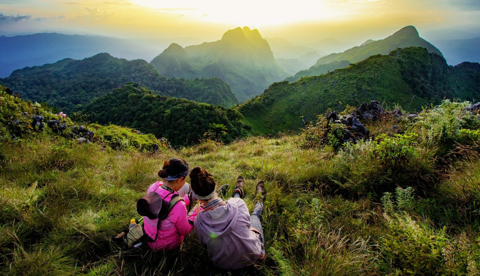
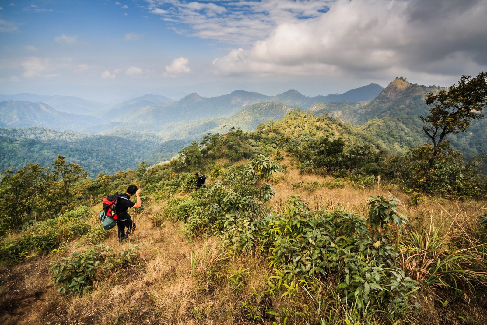
The actual ‘Star Mountain’ (the literal translation of its Thai name’) has been preserved from excessive development, but it is more and more difficult to go there and explore it. The park is only open for four months of the year, on three days a week, with a limit of 100 visitors per day. Those who want to visit Doi Chiang Dao must book well in advance. The difficulty does not reside in the 10 kilometre trek (the only one allowed inside the reserve), which rises by 1000m+, but in the arduous complexity of the necessary arrangements. That is the price to be paid nowadays if you want to get the chance to enjoy the natural world preserved in this magnificent park and the unbounded view over all the other mountains of the North that its summit affords.
Fortunately, it is possible to enjoy Chiang Dao in other ways without going into the reserve or climbing to its highest summit. First, you can visit the caves and hot springs lower down in the valley. To enjoy the whole mountain range you must visit some of the hill-tribe villages. The Hmong village of San Pa Khia to the south and the Lisu village of Na Lao Mai to the north offer equally fine views of Chiang Dao. For the more athletic, there is the option of spending 2 to 3 days hiking or mountain biking around Doi Chiang Dao and its little sister Doi Nang, which lies a few hundred metres to the north. Since 2014 Thailand Mountain Trail has recorded and brought back to life a large number of paths and has mapped out TMT.1, the first long-distance hiking trail in Thailand, linking Chiang Mai to Chiang Dao.
Phu Soi Dao, the protected secret mountain (2120m)
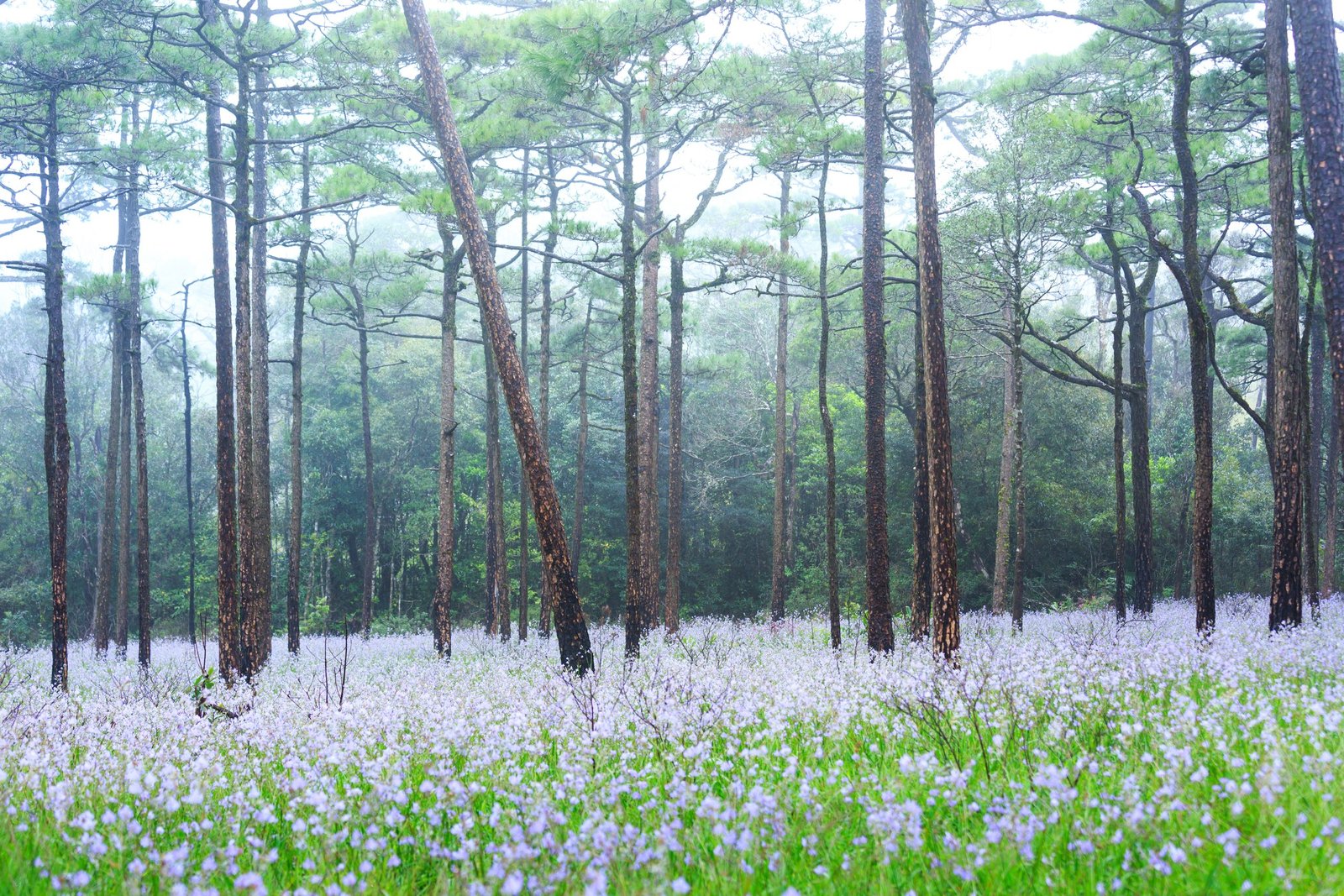
Stretching along the border of neighbouring Laos for sixty kilometers, Phu Soi Dao is one of the last National Parks created in Thailand. This reserve, which straddles the provinces of Phitsanulok and Uttharadit, was chosen for the richness of its flora and fauna almost fifteen years ago. The area, which is surrounded by other nature reserves (the Phu Miang-Phu Thong Wildlife Sanctuary and the Nam Pat Wildlife Sanctuary), is recognized for its different types of forest (tropical rain forest, temperate rain forest, pine forest, dry deciduous forest), for its wild animal populations (bears, boars, deer, barking monkeys) and for the great variety of its birds. It is hard to reach from any of the big Thai urban centres; the best way to get there is to go to Uttaradit and then take a two and a half hour journey by car. The rainy season, from July to October, is the best time to enjoy the grassy open spaces full of murdannia gigantea in full flower. The cold season (November to January), for its part, is valued for the mildness of the climate and the atmospherics of the mountainous landscapes wrapped in morning mist.
What is there to do on Phu Sao Doi and in its environs?
Given how far away the park is for visitors coming from Chiang Mai or Bangkok, it is better to spend several days in the area. The place has many marvellous natural sights and possesses an authentic atmosphere and local life, far from the ‘madding crowds’ of tourists. Go and see the rocks, pines and jungle in Doi Pha Klong National Park, the teak forests (which contain the oldest trees in the world) in Ton Sak Yai Forest Park and the caves at Tham Chan. The area is also plentifully supplied with lakes and waterfalls where it is very pleasant to spend time.
The real point of going to Phu Soi Dao is of course to trek up to its summit (2120m), the fourth highest in Thailand. Although it is technically possible to go up to the top and come back down in a single day, we advise you to spend two days on the trek, so that you can enjoy sunset and sunrise up there. The hike begins with a 1000 metre stretch of jungle, climbing for 7 kilometres, beside a pretty river and then along a ridge. Some steep sections lead to plateaux that open out onto the neighbouring mountains. The park’s camping ground is situated at 1600m, at the foot of the actual mountain, on a large open plain. To reach the summit and enjoy its superb views over Laos to the east and Thailand to the west it takes another one-hour hike to cover the final 3 kilometres and 500m rise in elevation.
Doi Langka Luang, a peak standing amid green mountains (2031m)
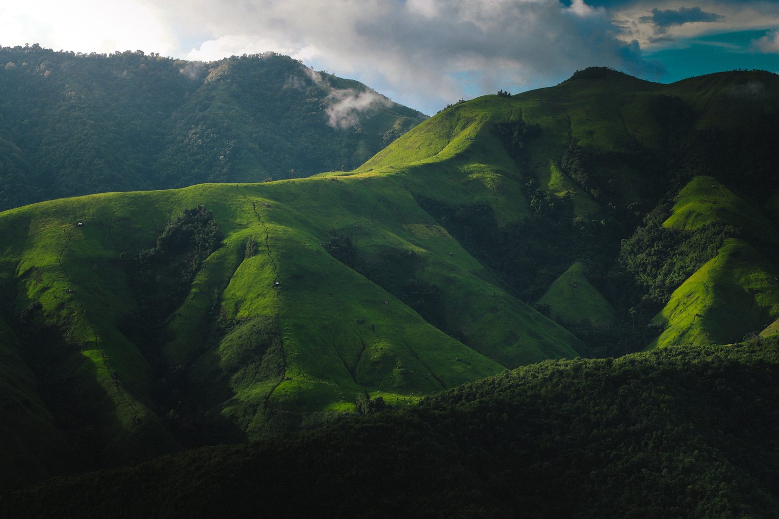
Doi Langka, also known as Doi Mae Tho, lies in the Khun Chae National Park, which covers 270 square kilometres and was established in 1995. On the borders of three provinces – Chiang Mai, Chiang Rai and Lampang – it is a very wild area with a climate that stays temperate throughout almost all the year. Here the vegetation on the ridges and peaks is less dense than elsewhere, which allows visitors magnificent 360 degree panoramic views. Doi Langka Noi rises to 1830m. Its wide summit is completely free of vegetation, offering an impressive view over all the other mountains. Doi Langka Luang (2031m) is the highest point of the area and also vegetation-free. Doi Langka lies one hour from the centre of Chiang Mai, to the east of Doi Saket, which is known for its coffee plantations and its protected natural environment. There are two ways of getting there: either by going to the headquarters of the Khun Chae National Park on the road to Chiang Rai, or by going to Mae Thon, the little village at the foot of the two peaks.
What is there to do in Doi Langka and its environs?
Before going to Doi Langka you should stop in the Doi Saket area. It is a superb place in which to spend a few days cycling, taking a break by the hot springs at Doi Saket or San Khampaeng, visiting coffee plantations and eating a meal higher up the mountain with an unrestricted view over the Chiang Mai valley. Another popular activity is a visit to Mae Khampong, a little village of teak houses tucked away in a small steep-sided valley. If you are a fan of waterfalls, there is a wide choice: Mae Khampong, Maetow, Khun Chae waterfall.
Doi Langka is a very steep limestone mountain. It can only be reached on foot. Ten years ago you had to start from the Khun Chae National Park headquarters and walk twenty or so kilometres from north to south on overgrown paths. The first hikers took 3 or 4 hours to cover the distance. Happily, thanks to TMT and the Park administration, new routes have been created, allowing hikers to reach the summits more quickly, without having to cross from north to south. So we recommend you to start out from Mae Thon. There are lots of loops which go to Langka Noi and Langka Luang. You must be in good shape, because it has to be a one-day hike, as there is no mountain village where you can overnight. For longer treks on Doi Langka, Thailand Mountain Trails has created TMT.2, the country’s second long-distance hiking path, which loops from Doi Saket to the two peaks in a two to three day trek.
The Thai Mountain Trail Project
Developing long-distance hiking paths to open up the mountains
The five highest mountains in Thailand all lie in the north of the country. Each of them has its own points of special interest, and they are all worth an extended visit. At present it can be hard for devotees of trekking to find ways of spending several days hiking about these areas. In contrast to the situation in National Parks in Europe, Britain or the United States, no government organization has yet taken an interest in setting up a network of mountain paths. For that reason Thailand Mountain Trail decided to do detailed research on hundreds of old paths and bring them back to life, with a view to creating long-distance hiking routes. In the next three years, the aim is to link Chiang Mai with all the highest peaks in the country. For some years now TMT.1 has joined Chiang Mai to Chiang Dao with a route 150 kilometres long, which rises by 9000 metres. TMT.2, which will create a loop from Chiang Mai to the summit of Doi Langka at 2030m, is in the process of completion. The creation of the next projected route, TMT.3, will get under way in 2023, with the objective of linking Chiang Mai to Doi Inthanon, the highest peak in the country. With a network of long-distance hiking paths of this sort in place, it will be very much easier to enjoy all these superb mountains while trekking or trail running.